Heritage Sites
Throughout the Inuvialuit Settlement Region there are many heritage sites. These locations are both culturally and historically relevant for many different reasons. Some of these sites are still very important to the Inuvialuit lifestyle and visited often.
You can learn a little about some of these locations below:
Heritage Sites
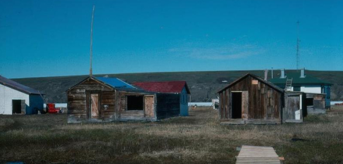
Qunngilaaq (Reindeer Station) was established in 1932 as the headquarters of the Reindeer Project which introduced reindeer husbandry into the Inuvialuit Settlement Region.
Lack of caribou in the coastal area prompted the Government of Canada to herd 3,442 reindeer from Alaska to provide a supplemental food source for the Inuvialuit after Mangilaluk refused to enter into a treaty with the government, instead opting for a long-term food source to benefit Inuvialuit rather than to take any money.
The 1,500 mile “Great Trek” to bring reindeer to this region, initially expected to take 18 months, stretched into a 5-year journey beset with perils of severe weather, high mountain ranges, supply shortages, wolves and other predators. In 1935, the surviving herd of 2,382 arrived in Kittigazuit. Sámi involved in the push to bring reindeer, stayed to teach more Inuvialuit how to look after the reindeer herd.
During its historic peek, Reindeer Station had a population of 90 – mainly herders and their families. It was a self-sustaining community with its own post office, power generating plant, school, church, and Hudson’s Bay trading post. Situated about 30 miles down river from Inuvik on the Mackenzie River’s East Channel, it also served as a supply centre for trappers operating in the area.
Due to a short season for vegetation growth, movement of the herd closer to the winter range, and introduction of modern herding techniques, employment opportunities diminished and the population of Reindeer Station dropped drastically.
In 1969 Reindeer Station was abandoned. Buildings were relocated and residents moved to Tuktoyaktuk or Inuvik. In 1974, the herd was sold to Canadian Reindeer Ltd.
Qikiqtaruk meaning “it is island” is part of the Yukon Territory and lies just off the north coast in the Beaufort Sea.
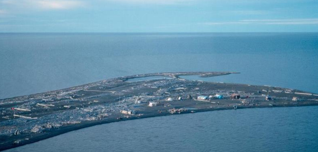
Pauline Cove, located on the southeast side of Herschel Island, is the only protective harbour between the Mackenzie River Delta and Point Barrow in Alaska. Its role as a haven for ships made it a key whaling port from 1890 to 1910.
Whalers would overwinter there to be close to the hunting area when the ice broke up. At the peak of the whaling era, nearly 2,000 American and European whalers, Inupiat from Alaska, and Inuvialuit lived at Pauline Cove. As well as being a whaling and trading center, the community contained police and government offices and an Anglican mission.
The Inuvialuit supplied food and clothing for the whalers in return for manufactured goods and southern food items including sugar, tea, and flour.
Although the whaling companies built houses and warehouses, most of the crews lived aboard the ships. A great deal of firewood was needed for the long, cold winters. The whalers quickly used up the local supply of driftwood and had to bring their own coal.
Herschel Island – Qikiqtaruk Territorial Park, Yukon’s first territorial park, was created as a result of the Inuvialuit Final Agreement. It protects a unique combination of natural and human heritage. Two of the warehouses and many of the whalers’ tiny cabins still stand. The Anglican mission house is now home to the largest colony in the Western Arctic of black guillemots, a diving sea bird related to the puffin.

Shingle Point or Tapqaq, located on a sand spit on the Yukon coast, was once the site of a thriving settlement.
Rhoda Allen describes Shingle Point when she was a child in the 1910s (excerpted from Yukon North Slope Inuvialuit Oral History):
“Long ago my dad used to bring us down to the coast to Tapqaq. We would stay there for a long while. Because there was a minister and Umauq and them … also there was a store then at Tapqaq, long ago. There was lots of people and houses inside the bay there. Then after staying for awhile, the big ship would come around. We have seen those with three masts on them … they would anchor in front of Tapqaq. Then they would unload the freight there. They were things like whaleboats from the ships.”
The first Anglican mission school for Inuvialuit children opened at Shingle Point in 1929 in a renovated Hud son’s Ba y warehouse. Log houses were built nearby for student housing and a church.
A series of epidemics brought by Tan’ngit (foreigners) took many Inuvialuit lives, decimating the population. Survivors moved from the coast to the inland communities of Aklavik and Tuktoyaktuk. In 1936, the mission school moved to Aklavik. Hudson’s Bay posts closed at Shingle Point, Herschel Island, and Barter Island, Alaska.
The coastal waters of the Beaufort Sea off Shingle Point are an important late-summer feeding area for whales. Shingle Point continues to be used as a summer camp for traditional pursuits such as fishing, whaling, hunting, and berry-picking.

Situated at the mouth of the East Channel of the Mackenzie River, Kitigaaryuit (also spelled Kittigazuit) is believed to have been the largest permanent Inuvialuit settlement before contact with the Tan’ngit. Excavations indicate the presence of people at Kitigaaryuit for at least 500 years.
Kitigaaryuit was an important site both as a base camp for whale hunting and a place to hold seasonal celebrations. Although people lived year-round at Kitigaaryuit, their number increased during the summer whale hunt.
It has been estimated that there were 1,000 Inuvialuit living there in 1850. As a result of epidemics, by 1905 the population was reduced to 259, and by 1910 to only 130.
In 1978, Kitigaaryuit was declared a National Historic Site.
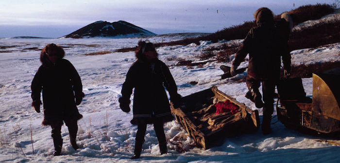
A pinguryuaq is an ice-cored hill that forms when groundwater freezes and with pressure of the ice underground is forced towards the surface. This usually occurs in an area where a lake has drained. Although covered by the rising ground, the inside of a pinguaryuk (small hill with ice core) and a pinguqsaaryuk (big hill with ice core) is made up of continually expanding ice.
Well over 1300 are scattered along the coastline near Tuktoyaktuk. Historically, these hills were utilized in a number of different ways, including navigation, hunting and storage.
The Western Arctic Land Claim Inuvialuit Final Agreement 7. (70) notes the intention of protecting the Ibyuit area jointly as Pingo Canadian Landmark.
