Innovation, Inuvialuit Science & Climate Change Projects At a Glance
Current Research of ISCC Division 2022/2023
This page highlights some ongoing research initiatives in which Inuvialuit Regional Corporation is a Principal Investigator or Co-applicant.*
While not an exhaustive list of all activities currently being worked on, this page will rotate to provide a glimpse of the overall work being done.
Completed projects are available on the Documents and Resources page.
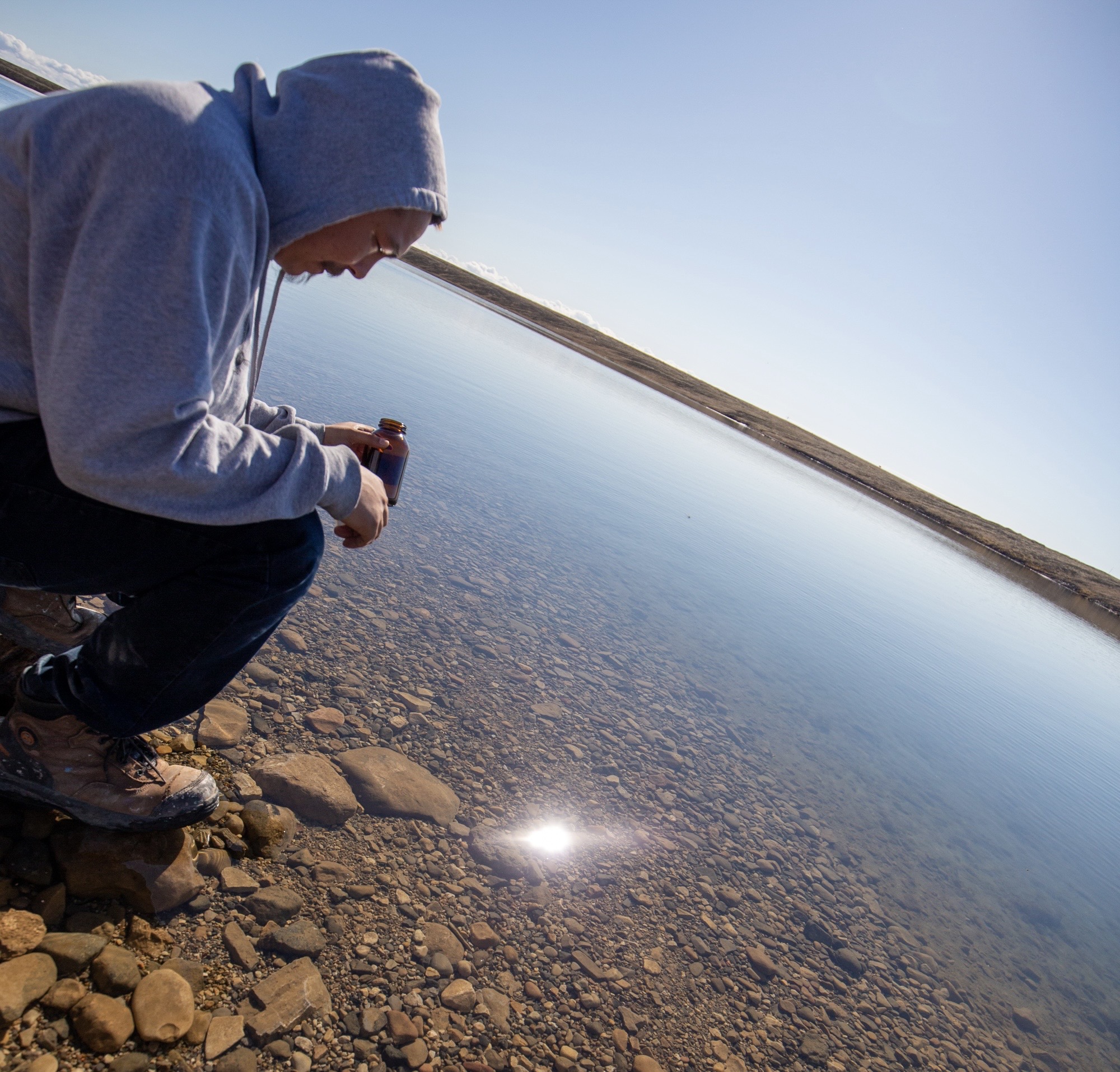
Photo: Cole Raddi helps collect water samples in Sachs Harbour summer 2023.
Health
Community Connections and COVID-19
COVID-19 and other infectious diseases spread when people are in contact with one another, but there is currently a very limited understanding of who is in contact with whom, and how often, in Inuvialuit communities. To accurately predict how a disease will spread and respond with appropriate public health measures (e.g., school closures, targeted vaccination, etc.), good data is needed on interpersonal contact rates. At present, the contact rate data used by Canadian epidemiologists are almost exclusively from large European cities. These data are unlikely to capture the realities of interpersonal contact patterns in Inuit communities where housing is limited and often overcrowded, harsh climates restrict where and how people can spend time, and traditional lifeways still structure many interactions. Inuvialuit Regional Corporation will use simple diary-based survey methods to fill this gap – asking people to record, for one day, who they are in contact with and how often. In the face of the COVID-19 pandemic, this work will provide a foundation for Inuvialuit and other remote Indigenous communities to access evidence-based, epidemiological insights on par with other Canadians.
Objective: To provide the foundation of good epidemiological understanding and help eradicate and prevent the spread of infectious diseases in the ISR and Inuit Nunangat.
Qanuippitaa? (How Are We?) National Inuit Health Survey (QNIHS)
Co-Lead: 4 Inuit Land Claim Organizations (or their designate), Inuit Tapiriit Kanatami
The four Inuit Land Claims Organizations (or their designates), in collaboration with Inuit Tapiriit Kanatami (ITK), have co-designed and are currently implementing a permanent survey on Inuit health and wellbeing in Canada. The survey is informed by Inuit knowledge, values, and worldviews and is characterized by a high level of Inuit stakeholder engagement, as well as the latest health sciences research. ISCC will govern and facilitate access to the survey data, including publishing results that are engaging and accessible to Inuit and organizations that serve Inuit populations. QNIHS data collection was successfully completed in May 2022; and data analysis is currently underway.
Objective: There is a lack of Inuit-determined, quality data on the health of Inuit in Canada. QNIHS aims to fill this gap by providing data that are: (a) relevant and culturally safe; (b) up-to-date; (c) comparable across populations and time; (d) comprehensive; (e) Inuit-determined and owned; and (f) easily accessible by Inuit.
Knowledge Mobilization
Improving Communication on Climate Change Terminology for Communities and Researchers in the Inuvialuit Settlement Region (ISR)
To help close the growing communication gap between Traditional Knowledge (TK) and climate change research and support the use of Inuvialuktun as the working language within the Inuvialuit Settlement Region (ISR), IRC will be hosting a series of terminology workshops to continue in the development of standard climate change terminology in all three dialects spoken across the ISR. The workshops will involve translators for all three Inuvialuktun dialects, IRC language professionals and Youth language learners. The results of these workshops will be contained in a Climate Change Terminology Glossary that will be available online and publicly distributed to community members and researchers.
Objective: By completing this project, IRC will standardize climate change language and develop a publicly accessible Terminology Glossary. This will ease communication between communities and researchers as they complete work relating to energy and climate change and will support using Inuvialuktun as the working language within the Inuvialuit Settlement Region.
A Special Day with my Anaanak – A Children’s Book on Knowledge Transfer
This project aims to develop a knowledge-transfer themed children’s book which will be available in English and all three Inuvialuktun dialects. The book’s content will highlight themes of knowledge transfer between Elders and Youth and highlight terminology related to the environment. Project development will require several stages of community participation, including a story writing contest, the meeting of a selection committee, and the creation of illustrations by local artists. The final product will be publicly available in both printed and audiobook formats.
Objective: To create a knowledge transfer-themed Inuvialuit children’s book and accompanying audiobook in English and the three Inuvialuktun dialects and, in turn, promote Inuvialuit language and environmental literacy in the ISR.
Boating Safety in the ISR
Inuvialuit rely on ISR waterways for social, cultural, and subsistence purposes. In recent years, however, there has been an increased number of national and international shipping voyages. This increase in shipping also increases the risk of encounters between large vessels and small vessels. This project therefore aims to increase the safety of ISR waterways and, by extension, Inuvialuit residents by creating easy-to-read educational materials outlining best practices for large vessel-small vessel encounters. This program also aims to increase safety by providing boating safety gear and equipment to Inuvialuit in each of the six ISR communities. Equipment will include safety items, such as bailers, flashlights, whistles, electronic flares, and a manual propelling device.
Objective: To proactively create safer waterways by increasing awareness, encouraging safe boating compliance, and equipping Inuvialuit with the means and tools to respond to waterway emergencies while undertaking their traditional activities.
Advancing Arctic Research through Connected Data Infrastructure
Co-Lead: Inuvialuit Regional Corporation, Academia, Industry
The Canadian Consortium for Arctic Data Interoperability will develop an Arctic Research Data Infrastructure predicated on a vision to support and grow a research community that (1) fully engages Inuit; (2) is properly governed so as to enhance individual, local, regional, national, and international initiatives in data management and research; and (3) builds capacity across a network of linked data centres with common standards, practices, tools, and expertise. The Consortium will facilitate data discovery and description and enable data to be shared across systems for upload, analysis, and visualization. It will also support efficient and effective use of data, allowing Canada to better realize the benefits of our decades of investment in Arctic research.
Objective: (a) support Inuit self-determination; (b) enable informed actions for managing decision-making around multiple issues; (c) support operational activities by making information from space-based technologies more accessible and usable to those charged with search and rescue; and (d) ensure safe transportation and protection of life, environment, and infrastructure in Canada’s Arctic.
Inuvialuit Settlement Region Platform
Co-Lead: Inuvialuit Regional Corporation, Fisheries and Oceans Canada
Since 2013, the Beaufort Sea Partnership has been developing the Inuvialuit Settlement Region Platform in support of the Integrated Oceans Management Plan (https://bsp.maps.arcgis.com). This cloud-based platform provides a “one window approach” to data storage, mapping, and application development, facilitating collaborative ISR decision-making. Featuring tools for field data collection, custom-base maps, analysis capabilities, print applications and over 400 spatial layers, the BSOP currently supports 32 BSP organizations, including the Inuvialuit Land Administration, Wildlife Management Advisory Councils, Fisheries Joint Management Committee and the Joint Secretariat. This platform is administered solely by IRC, who aims to continually expand the site to meet user needs.
Objective: To improve communication/information sharing between Beaufort Sea Partners related to Integrated Ocean Management Planning and provide a continually expanding platform for innovative research.
Inuvialuit Climate Watch Program
Partner: Inuvialuit Regional Corporation, Meteorological Service of Canada, Natural Resources Canada, SmartICE, Inuit Circumpolar Council
The Climate Watch project was initially conceptualized to fill this knowledge gap by utilizing the extensive network of research and community-based monitoring programs in the ISR to contribute regional observations to the Arctic Regional Climate Centre products. The project concept has since expanded to include the mobilization of seasonal climate information in an accessible format to Inuvialuit beneficiaries, local organizations, and other interested groups.
Objective: To consolidate climate-related information in a format relevant to Inuvialuit communities and enable meaningful Inuvialuit contributions to the circumpolar discourse on seasonal climate observations and projections.
Inuvialuit Settlement Region Climate Change Action Map
While the ISR has emerged as a climate change research and action hub, a historical information gap between Inuvialuit stakeholders and project leaders continues to challenge community awareness of the wide range of initiatives that have taken place across the region in recent years. This project aims to raise community awareness by developing an easily accessible, user-friendly and comprehensive online map that will help users visualize the expanding scope of climate action in the ISR. This map also serves as an engagement tool for encouraging participation in future climate change initiatives within Inuvialuit communities and promoting the region’s progress toward sustainability to audiences beyond the ISR.
Objective: To showcase recent climate change and clean energy initiatives across the ISR to Inuvialuit stakeholders and the public at large.
Climate Change and Environment
Investigating Water Quality in Fish-Bearing Lakes in Inuvik, NT
Inuvik lakes hold cultural and spiritual importance to local residents, as well as economic value through harvesting, fishing, and trapping. However, with the all-season Inuvik-Tuktoyaktuk Highway built in 2017, the area has become more accessible and has increased highway traffic and touristic activities. Emissions from vehicular exhaust, as well as the leaching of potential contaminants, including oil and gasoline, have been implicated in many health issues in plants, aquatic animals, and humans. Solid waste from human activities can also contaminate waterways, affecting the habitat and health of the occupants.
Objective: This project aims to develop a long-term water quality database, which will enable Inuvialuit to document and monitor water conditions, ensuring that lakes remain healthy and productive. Early detection of declining water quality is essential to preventing long-term impacts on ecosystems and, by extension, Inuvialuit health and wellbeing.
Evaluating Microplastics and Additive Concentrations in ISR Waterways
Microplastics are a key concern to eco-systemic and human health as they accumulate in water, soil and through the food chain; and more data is needed to evaluate risks. Microplastics enter the environment, either as primary microplastics (found in health and beauty products like cosmetics, toothpaste, and soaps) or as secondary microplastics (found in consumer products like bottles, bags, fabrics, and packaging). Humans inhale and ingest microplastics––and while this exposure is generally thought to be safe––some microplastics have additives that may potentially be toxic or carcinogenic. Evaluating the distribution and abundance of microplastics in drinking water will allow Inuvialuit to document water conditions, mitigate accumulation and affect policy changes as needed.
Objective: To evaluate the distribution and abundance of primary and secondary microplastics in drinking water across the six communities of the ISR.
Applied Research
Inuvialuit Place Names
Over the centuries, Inuvialuit have lived and travelled throughout their land and given names to camping places, settlements, and landmarks. These names may reflect the kinds of activities that were carried out at those places, the kinds of resources the area is known for, or events that occurred there. Place names help to shape and define the cultural landscape and are an enduring record of Inuvialuit history and heritage. Knowing place names and their meanings, the resources or landmarks at those locations, and the sequence of those place names as people journeyed along travel routes was one way that Inuvialuit learned to read the land without a writing system or printed maps. These locations are of central importance when identifying key areas of significance within the ISR. Place name information will be complied from existing research and will include names documented on maps and in interviews (both English and Inuvialuktun).
Objective: Develop a consolidated and quality-controlled map of place names within the ISR which can be used to identify key areas of consideration when assessing the potential for natural resource development.
ISR Coastal Erosion Modelling from Satellite Imagery
Co-Lead: Inuvialuit Regional Corporation, Academia, Industry
As climate change accelerates, the coastline of the Inuvialuit Settlement Region will experience some the earliest and most extreme changes. To prepare for this, we are using satellite imagery to a) pin-point exactly where the coastline is today; b) track how the coastline has changed; and c) predict how likely the coastline is to change in the future. These predictions can be combined with other data on archaeological sites, cabin locations, or hunting, fishing and trapping areas to allow for better mitigation of the effects of coastal erosion.
Objective: (1) To develop an accurate description of the ISR coastline and develop a predictive model of where and how quickly the coastline is likely to erode; and (2) apply the model to predict impacts of coastal erosion on social, cultural and archaeological sites.
The Role of Genomics in Fostering and Supporting Arctic Biodiversity: Implications for Policy and Indigenous Food Security
Co-Lead: Inuvialuit Regional Corporation, Academia, Industry
Genome information is extremely valuable for environmental decision making, yet much remains unused for this purpose. Project activities and outcomes will support conservation, natural resource management, and the sustainability of Arctic food sources. Outcomes will also support Canada’s efforts to protect Arctic species and ensure northern food security. The project can serve as a model for mobilizing genomics in different regions of Canada and in other nations. Work will focus on reindeer/caribou and marine mammals.
Objective: To co-develop a suite of genomics knowledge-mobilization tools that will support ‘evidence-based’ social and economic decision making.
Using Traditional and Local Knowledge to Better Understand the State of the Beaufort Sea
This study will be conducted in three phases using a full-time traditional knowledge (TK) expert to guide the project. The first phase involves the compilation of existing information to identify gaps to be addressed during the second phase. The second phase fills in the identified gaps through multi-day community workshops that have both an outdoor and indoor component. Participants will include knowledge holders, youth, and Elders. During the final phase of the project, we will compile the collected information into an interactive website that includes stories, photos and discussion summaries. We will also develop educational materials for K-12 students to promote Inuvialuit culture.
Objective: The purpose of this project is to document the multifaceted social, psychological, cultural, and economic relationships that Inuvialuit have with the Beaufort Sea. The project will use participant experiences to drive the investigation and will produce results to help Inuvialuit champion management of the Beaufort Sea.
Research Data Rescue and Management
The ISSC is in the process of organizing IRC data holdings to better serve the development of policy and operational initiatives. Data projects include the upgrade of the Network Attached Storage (NAS) system to store data securely and efficiently. Another task is the extraction and preservation of historical harvest data from obsolete storage devices (i.e., data rescue). The harvest data has been rescued and is being organized so that it can be made available for the examination of historical Inuvialuit harvesting trends of important land and marine mammals. In addition, the ISCC is also in the process cataloging data (i.e., creating metadata files) to make the data findable in searches, more accessible and more useable. Data will be presented on an indicator dashboard that will be accessible to Inuvialuit and provide support for decision-making.
Objective: By completing these projects, the IRC will have efficient access to data sources and corresponding indicators. As a result, Inuvialuit will have additional data and tools to support evidenced-based decision-making.
Socio-Cultural Economic Indicators
The long-term goals of Inuvialuit self-governance and self-direction require a foundation of reliable social, cultural, and economic data. Good governance is facilitated by access to accurate information on topics such as housing, health, social needs, and economic preferences. To support these goals, ISCC are building institutions that will continually acquire, manage, and present regional data on these topics. The work includes forming partnerships with data-holding organizations, developing internal capacity–––including policies, systems, and staff training––and cataloguing and making available the data we already have.
Objective: To support evidence-based decision-making in the Inuvialuit Settlement Region by ensuring that the highest quality of social, cultural and economic data is available to decision-makers.
Small Area Methods to Analyze Family and Domestic Violence in the Inuvialuit Settlement Region
There is a longstanding need to understand the extent and magnitude of the family and domestic violence situation in the Inuvialuit Settlement Region (ISR). The National Inuit Action Plan on Missing and Murdered Inuit Women, Girls and 2SLGBTQQIA+ persons mandates access to the best available data and information to help inform effective solutions for preventing violence against members of these vulnerable groups. The Action Plan identifies the limited availability of information linked to violence as one of the most significant barriers to preventing violence. In response to this need, the purpose of this project is to close the existing data gap by determining reliable family and domestic violence indicators in the ISR. This mixed methods study was designed and led by IRC’s Innovation, Inuvialuit Science and Climate Change Division (ISCC). The project is supported by IRC’s Health and Wellness Division, with advisory support from other organizations.
Objective: The objective of this project is twofold: (1) Using available sources of ISR-specific data, develop baseline indicators of family and domestic violence in the region; (2) Gather qualitative information from frontline and support workers on their perspectives about family and domestic violence in their respective ISR communities.
If you have any questions concerning these, or other research projects, please contact:
Jenn Parrott
Director, Innovation, Science & Climate Change
107 Mackenzie Road
Bag Service #21
Inuvik, NT X0E 0T0
Tel: (867) 777-7053
Email: jparrott@inuvialuit.com